
Brisbane City Community Preparedness
How can we use open and public data to understand the community’s level of preparedness for disruption to inform Council’s response and recovery efforts?
Go to Challenge | 3 teams have entered this challenge.
Team Name:
Lucidity is Optional
Team Members:
Lucidity is Optional
We are thrilled to present the SEQPrepare – a custom solution designed to improve the disaster preparedness and response in South East Queensland. In a region prone to severe weather incidents, this innovative app serves as an essential tool to protect our community, homes, and loved ones. By harnessing the power of open government data, SEQPrepare empowers residents with vital information, personalized insights, and actionable steps to mitigate risks and navigate these challenges effectively.


The app provides every homeowner with a tailored risk assessment of their property. By analyzing real-time data and historical patterns, it offers a comprehensive understanding of your property's susceptibility to fire and flood events. Armed with this knowledge, residents can take informed measures to fortify their homes and prepare a suitable evacuation strategy.
Stay ahead of the weather with instant alerts delivered straight to your smartphone. Whether it's an approaching bushfire, a rising water level, or evacuation advisories, the app ensures that you receive crucial updates in real time.
We understand that preparedness is paramount. The app helps residents craft personalized action plans that cater to your property's specific risks. Whether it's creating defensible spaces, securing valuables, or having an evacuation strategy, the app provides step-by-step guidance that takes the stress out of emergency planning.
SEQPrepare is not just a personal safety tool, it provides a vital bridge between residents and their local council. SEQPrepare provides anonymous data to councils to help council understand a region's preparedness and implement targeted strategies that bolster community resilience.
In times of crisis, access vital resources at your fingertips. From emergency contact numbers to shelter locations and premade evacuation plans.
SEQPrepare has been built with extendability in mind to ensure it can be adapted to any and all future weather risks. The prototype already includes an example section for cyclone risk data.
For a live demonstration and further details we invite anybody interested to test our prototype at seqprepare.xyz. It currently has accurate fire and flood data, along with mock data for some other app features. Note: your GPS location will be sent to our API server for the purpose of retrieving location-specific flood data. This information is not stored or logged.
At the heart of SEQPrepare is open government data from every level of government. We determine current SEQ Fire risk data via the BOM Open Data FTP Site, we also use the live data feed from the Queensland Fire and Service for live fire data along with a host of local council data sources for flood risk, realtime stream height information and address data.
Description of Use Used to determine flood hazard metrics for properties located within the Moreton Bay region
Description of Use Live stream height data used to determine live flood risk
Description of Use Used to determine stream warning height for flooding and the flood risk at each property
Description of Use Used in conjunction with the Google Maps API to convert GPS coordinates to LotPlan numbers
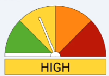
Description of Use This is used to show today's fire danger rating to the user when they open the app.
Description of Use This is used to discover whether there are any bushfires close to the user and advise them of a possible course of action based on current warnings.
Go to Challenge | 3 teams have entered this challenge.
Go to Challenge | 9 teams have entered this challenge.
Go to Challenge | 7 teams have entered this challenge.